Walks near Woldingham
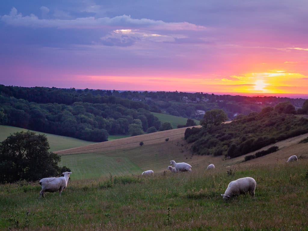
These walks near Woldingham all lead to Botley Hill Farmhouse. The farmhouse sits right on the North Downs, next to the Titsey Estate with its historic house and gardens. St Agatha’s Church in Woldingham is close by, and its churchyard has a yew tree believed to be 750 years old. Start a walk from the pub, or arrive on foot from Oxted or Woldingham station. Please book a table in advance if you plan to eat with us afterwards.
Each of the three routes below has clear directions, a distance and a difficulty rating, so you can choose the walk that suits you.
Three walks near Woldingham
| Walk | Route | Distance |
|---|---|---|
| One | Oxted Station to Botley Hill Farmhouse | About 2.5 miles one way (5.5 miles as a circular walk) |
| Two | Around the Titsey Estate and Oxted | About 5.5 miles |
| Three | Woldingham Station to Botley Hill Farmhouse | About 3.7 miles |
Walk One: Oxted Station to Botley Hill Farmhouse
Easy to moderate. About 2.5 miles one way (5.5 miles as a circular walk). Starts at Oxted Station and finishes at the farmhouse, through the Titsey Estate woodlands.
- Leave Oxted Station onto Station Road East and turn left, passing Waitrose on your left.
- At the roundabout turn right onto Bluehouse Lane and follow it for about three quarters of a mile, passing the Barn Theatre and Oxted School on your left.
- Just after the school turn left onto Park Road. At the sharp bend take the public footpath straight ahead.
- The path leads to a large field, which can be muddy. Head for the top left-hand corner and cross the footbridge over the M25, then turn left along the field boundary.
- After a gentle climb you reach a notice board on your right with a gap in the trees. Keep to the left-hand path.
- You are now on a Titsey Estate walk. Follow the red arrows up through the woodland, on a path with wooden handrails.
- Take the left fork on the wide chalky path, and at the crossroads of tracks turn left up the hill onto Pitchfont Lane. It isn’t much of a lane.
- At the top turn left out of the car park onto Limpsfield Road. The farmhouse is about a quarter of a mile along on your left.
For the circular walk, retrace your steps to Pitchfont Lane and carry on downhill through the farm buildings to the road at the bottom. Turn right and go under the motorway bridge, take the first right onto Park Road, bear left into Bluehouse Lane, then turn right and pass the Barn Theatre and Oxted School back to the station.
Walk Two: Around the Titsey Estate and Oxted
Moderate, with some steep hills. About 5.5 miles. A circular walk from the farmhouse car park over farm tracks, bridleways and field edges, with stiles, kissing gates and long steep slopes.
- Turn left out of the car park and follow the road for about three quarters of a mile, crossing where the pavement changes sides.
- Take the bridleway on the left, a broad farm track, and follow it down the hill for about three quarters of a mile.
- Take the footpath on the left over a stile. Keep to the left edge of the field and climb over the hill.
- Cross the next stile onto a country lane, turn left and walk a quarter of a mile, then take the bridleway on the left. It climbs a long slope for about a mile.
- Follow the track until it becomes tarmac and reaches a crossroads. Cross carefully and continue the same way along the narrow road, watching for traffic.
- After 150 metres take the footpath on the left. At the fork 30 metres on, take the left branch to a stile and cross onto the southern face of the North Downs.
- Walk due south towards the M25 and descend the steep hill to a crossing point at the bottom, then turn left. The path is sometimes hard to find here.
- Follow the path through kissing gates and over a stile to Pitchfont Lane. Turn left up the track to Limpsfield Road.
- Turn left and follow Limpsfield Road back to the farmhouse.
Walk Three: Woldingham Station to Botley Hill Farmhouse
Easy to moderate. About 3.7 miles. Starts at the exit of Woldingham Station car park and finishes at the farmhouse, passing St Agatha’s Church.
- At the station car park exit turn right onto Church Lane and follow it uphill for about a mile and a quarter, closing any farm gates behind you.
- You pass St Agatha’s Church on your right. The yew tree in its churchyard is believed to be around 750 years old.
- At the top of Church Lane turn left onto Northdown Road and follow it to the Green, passing a building that was once a pub.
- Turn right down Slines Oak Road and keep going for quite a way, ignoring the side roads and footpaths.
- Turn right onto the signposted track called Upland Road, beside Warren Barn Farm, and follow it to the top of the hill.
- At the end of the track turn right onto Limpsfield Road. The farmhouse is on your right.
Before you set off
Customers sent in these pub walks near Woldingham, and they are correct to the best of our knowledge. Paths and stiles change, so check conditions before you go. Fields can be muddy, some descents are steep, and several roads have fast traffic. Wear sensible footwear and take care. If you spot a change or have a route to suggest, email us at the address on the Contact page.
Whichever of our pub walks near Woldingham you choose, there is a warm welcome and good food waiting at the end.